On display now at the Center for Architecture in Portland, Oregon, is an inspiring view into the design processes of Snøhetta, the internationally renowned design firm partnering with Mayer/Reed on the Willamette Falls Riverwalk and the James Beard Public Market.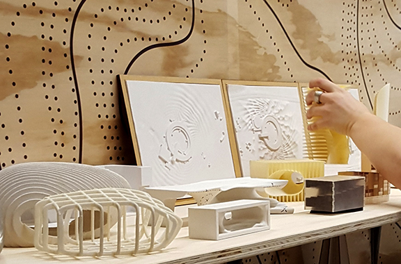
With an emphasis on studio culture and design philosophy, Snøhetta: People, Process, Projects, is Snohetta’s first full-scale exhibit in the U.S. on view through June 30, 2016, with a public reception on First Thursday, June 2nd from 5:30-9:00 pm.
Re-imagining Portland’s Central Eastside as a River District
I recently presented in a discussion forum called “Central Eastside: Beyond Taking Sides” at Bora Architects during Design Week. I took this opportunity to depict an idea that I’ve thought about for decades.
Imagine the future Central Eastside Industrial District (CEID) as a very different place than it is today. While preserving it as primarily an employment-driven sector of the city, envision a place that’s more active and better connected to the river as it once was before construction of the I-5 freeway. Imagine a place where people walk down locally connected streets through the commercial, industrial, neighborhood areas to the river.
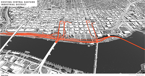
I’m not a transportation planner; I am coming at this idea wholly from an urban design and land-use perspective. This much is clear to me: it may be feasible to expand and unlock the potential of the CEID with more development parcels by replacing the interstate freeway with a local, on-grade high-capacity street. Only then can we re-establish surface streets that will enable greater local connectivity and eliminate the spaghetti of ramps and undeveloped land in our central city.
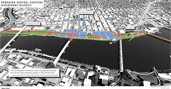
East-west surface streets connect to this new on-grade boulevard. Morrison and Hawthorne Bridges’ viaducts come to grade after they fly over the boulevard and railroad, similar to Portland’s Lovejoy ramp at the foot of the Broadway Bridge. This vision recaptures land for both expanded riverfront park and approximately 24 blocks of private development. Mixed-use development blocks adjacent to the bridges yield potential for a more active commercial waterfront; more generous open space pairs well with the Esplanade. Perhaps northbound traffic could be accommodated on the lower deck of the Marquam Bridge with southbound traffic on a new lower deck if it can be designed to meet marine clearances set by the Tilikum Crossing.
And the Marquam’s existing upper deck? Retrofit it as an incredible linear park called, “Portland’s Higher Line Trail!”
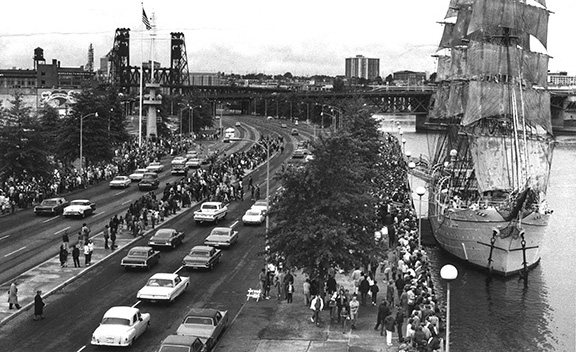
When Mayer/Reed was designing the Eastbank Esplanade before its opening in 2001, people asked whether the project was really worth doing until the freeway was removed. I would respond by saying that we as a city would never demand alternatives to I-5 until we provided this important public access to the river. Only then would people truly understand the value of our waterfront.
Fifteen years later, I feel it’s finally time to put more thought into transportation and land use alternatives for the future. Let’s seriously consider multi-modal transportation links along with more blocks in the CEID for growth, job creation, and connectivity to the river.
Two Case Studies:
Harbor Drive / Governor Tom McCall Waterfront Park, Portland, OR

In the 1970s, Portland became known as a visionary city by replacing Harbor Drive freeway with Gov. Tom McCall Waterfront Park and Naito Parkway. In fact, this move has been frequently cited as a milestone in urban planning. Meanwhile, the 1960s era I-5 cut off the CEID, complicated bridge connections and made local access more difficult. Over time, the CEID became disconnected and seemed to lose its soul.
The Embarcadero, San Francisco, CA
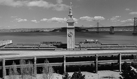

A large earthquake allowed San Francisco to re-imagine the freeway rimming its frontage on the bay. When all the debris was cleared and infrastructure put into place, an entirely new waterfront emerged. Now the on-grade Embarcadero provides multi-modal transportation links and a character-defining, pedestrian-friendly street that features historic buildings, parks and an active waterfront.
The Orange Line Continues to Impress!
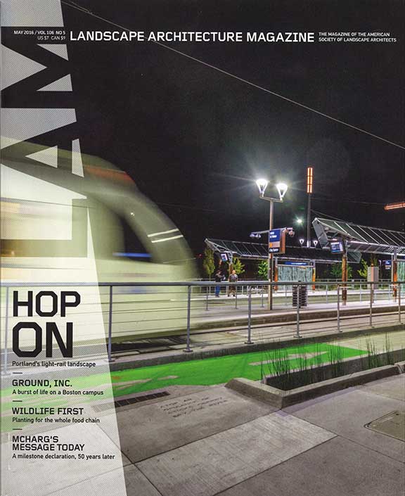 “Need you wonder why we started a drinking game called ‘Portland’ here at the magazine?” says Landscape Architecture Magazine. “The Oregon metropolis always has so much to show for its progressive thinking. A large team of landscape architects and other designers can take credit and pride in the new MAX Orange Line, seen on LAM’s cover this month.”
The May issue features a robust cover story about Portland’s latest multi-modal transit project. Check it out!